


montgenevre la source de la durance

labarone
User
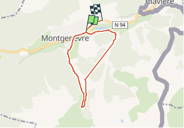

Length
6.3 km

Max alt
2068 m

Uphill gradient
234 m
Km-Effort
9.4 km

Min alt
1842 m

Downhill gradient
239 m
Boucle
No
Creation date :
2022-07-01 07:08:26.201
Updated on :
2022-07-02 05:49:00.462
3h32
Difficulty : Easy

FREE GPS app for hiking
 SityTrail
IGN / Geographical institutes
SityTrail Plus
The world is yours!
About
Trail Walking of 6.3 km to be discovered at Provence-Alpes-Côte d'Azur, Hautes-Alpes, Montgenèvre. This trail is proposed by labarone.
Description
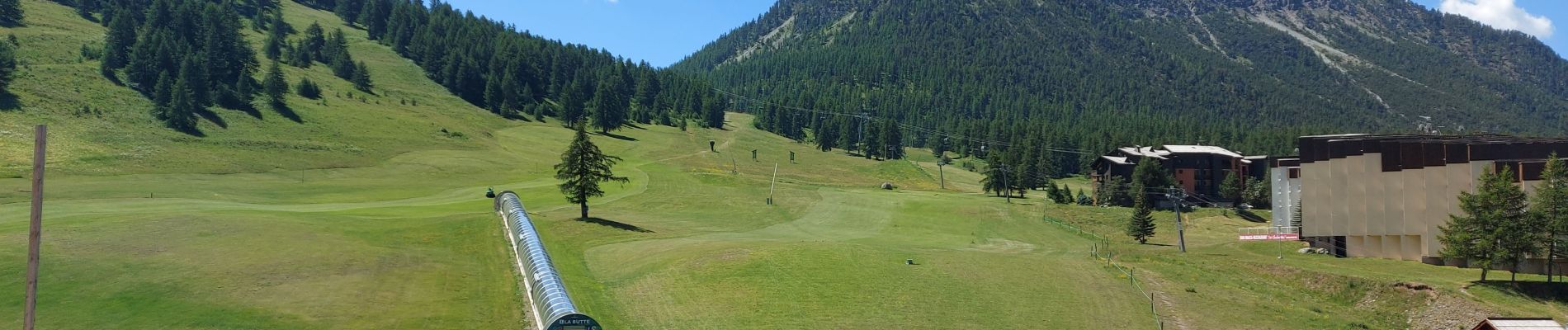
toujours aussi beau
végétation et insecte
Avec notre guide de ma semaine : Anne super sympa et compétente en botanique histoire Nous la recommandons !
Photos


Positioning
Country:
France
Region :
Provence-Alpes-Côte d'Azur
Department/Province :
Hautes-Alpes
Municipality :
Montgenèvre
Location:
Unknown
Start:(Dec)
Start:(UTM)
320528 ; 4977860 (32T) N.
Comments