


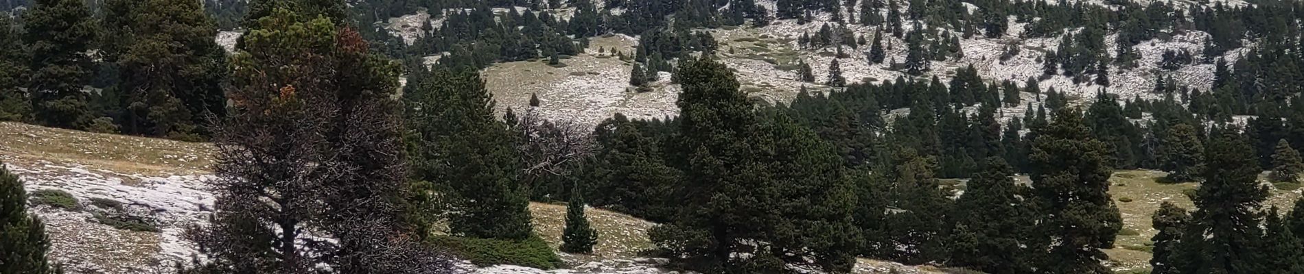
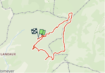
pas des Bachassons/Chabrinelle-Romeyet

okfred26
User

Length
19.3 km

Max alt
1673 m

Uphill gradient
998 m
Km-Effort
33 km

Min alt
1004 m

Downhill gradient
1004 m
Boucle
Yes
Creation date :
2022-06-30 06:56:31.258
Updated on :
2022-07-02 09:06:40.415
8h16
Difficulty : Difficult

FREE GPS app for hiking
 SityTrail
IGN / Geographical institutes
SityTrail Plus
The world is yours!
About
Trail Walking of 19.3 km to be discovered at Auvergne-Rhône-Alpes, Drôme, Romeyer. This trail is proposed by okfred26.
Photos


Positioning
Country:
France
Region :
Auvergne-Rhône-Alpes
Department/Province :
Drôme
Municipality :
Romeyer
Location:
Unknown
Start:(Dec)
Start:(UTM)
693455 ; 4964329 (31T) N.
Comments