jour 2 et 3 SityTrail > Trails > Outdoor > France > New Aquitaine > Gironde > Saint-Ciers-sur-Gironde SityTrail > Trails > Outdoor > France > New Aquitaine > Gironde > Saint-Ciers-sur-Gironde jour 2 et 3 albert318 User 3D © OpenStreetMap contributors Length 133 km Max alt 111 m Uphill gradient 1020 m Km-Effort 146 km Min alt -4 m Downhill gradient 1006 m Boucle No Creation date : 2022-07-03 09:13:43.035 Updated on : 2022-07-04 18:27:09.297 (0 Reviews) Bicycle tourism 31h35 Difficulty : Very difficult FREE GPS app for hiking SityTrail IGN / Geographical institutes SityTrail World The world is yours! About 
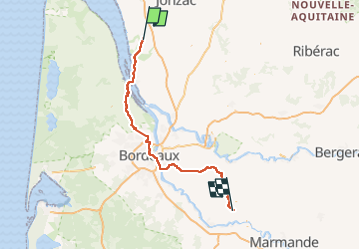
Trail Bicycle tourism of 133 km to be discovered at New Aquitaine, Gironde, Saint-Ciers-sur-Gironde. This trail is proposed by albert318. Legends | More details (PDF) Elevation profile Legends > 15% 15% - 10% 10% - 5% flat 5% - 10% 10% - 15% 15% - 30% > 30% Positioning Country: France Region : New Aquitaine Department/Province : Gironde Municipality : Saint-Ciers-sur-Gironde Location: Unknown Start:(Dec) 45.290925675071776 / -0.6109043676406145 Start:(UTM) 687341 ; 5018046 (30T) N. Comments Please log in to post a review or rate the element Trails nearby bessonpaul 13 14 15 16 St Aubin de Blaye Barp Walking Medium Saint-Aubin-de-Blaye, New Aquitaine, Gironde, France 97 km | 105 km-effort 2h 27min No phelan Vélo étape 2, Baud St Louis - Le Plan -Médoc Bicycle tourism Very easy Braud-et-Saint-Louis, New Aquitaine, Gironde, France 53 km | 57 km-effort Unknown No phelan Sage 2. Braud et Saint Louis -> Le Pian-Médoc Electric bike Very easy Braud-et-Saint-Louis, New Aquitaine, Gironde, France 54 km | 58 km-effort Unknown No