


fhhh

appreview
User

Length
939 km

Max alt
747 m

Uphill gradient
14432 m
Km-Effort
1131 km

Min alt
31 m

Downhill gradient
14377 m
Boucle
No
Creation date :
2022-07-06 16:59:30.279
Updated on :
2022-07-06 16:59:34.521
2m
Difficulty : Very easy

FREE GPS app for hiking
 SityTrail
IGN / Geographical institutes
SityTrail Plus
The world is yours!
About
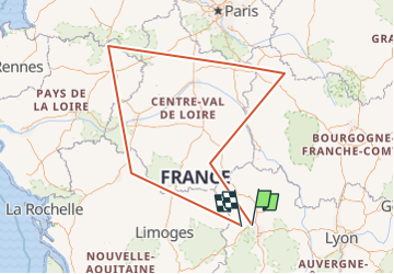
Trail Walking of 939 km to be discovered at Auvergne-Rhône-Alpes, Puy-de-Dôme, Loubeyrat. This trail is proposed by appreview.
Description
gggghhh
Positioning
Country:
France
Region :
Auvergne-Rhône-Alpes
Department/Province :
Puy-de-Dôme
Municipality :
Loubeyrat
Location:
Unknown
Start:(Dec)
Start:(UTM)
502372 ; 5086774 (31T) N.
Comments