![](/images/other/stat-length.png)
![Trail Walking Chuyer - 42-Chuyer-mont-Ministre-19km-685m-été - Photo](https://media.geolcdn.com/t/1900/400/ext.pjpeg?maxdim=2&url=https%3A%2F%2Fmedia.geolcdn.com%2Ff%2Feffa4503-778b-47fa-ac8d-c1f86e2f0d53.jpg)
42-Chuyer-mont-Ministre-19km-685m-été
SyMA
User
![Length](/images/other/stat-length.png)
Length
19 km
![Max alt](https://static1.geolcdn.com/siteimages/upload/files/1508320355ic_sort_altitude_max_24dp.png)
Max alt
760 m
![Uphill gradient](https://static1.geolcdn.com/siteimages/upload/files/1508320355ic_sort_den_pos_24dp.png)
Uphill gradient
684 m
![Km-Effort](/images/other/stat-length.png)
Km-Effort
28 km
![Min alt](https://static1.geolcdn.com/siteimages/upload/files/1508320355ic_sort_altitude_min_24dp.png)
Min alt
440 m
![Downhill gradient](https://static1.geolcdn.com/siteimages/upload/files/1508320355ic_sort_den_neg_24dp.png)
Downhill gradient
685 m
![Boucle](https://static1.geolcdn.com/siteimages/upload/files/16400158638029165_repeat_loop_refresh_sync_direction_icon.png)
Boucle
Yes
Creation date :
2022-07-07 07:00:22.766
Updated on :
2022-07-07 16:53:52.39
![Walking](https://static1.geolcdn.com/sitytour/trail-icons/101.png)
5h50
Difficulty : Medium
![Scan this QR Code to open this trail in the SityTrail application](https://capi.geolives.com/qq0zvz2zws4bq2lad0pu/sitytour/trails/3307927/qr.png?size=200)
FREE GPS app for hiking
About
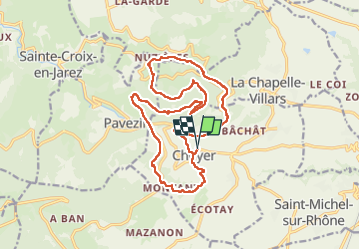
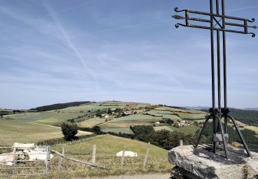
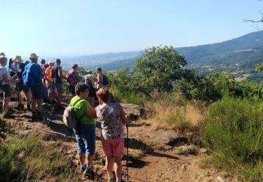
Trail Walking of 19 km to be discovered at Auvergne-Rhône-Alpes, Loire, Chuyer. This trail is proposed by SyMA.
Description
Départ cimetière de Chuyer (toilettes )
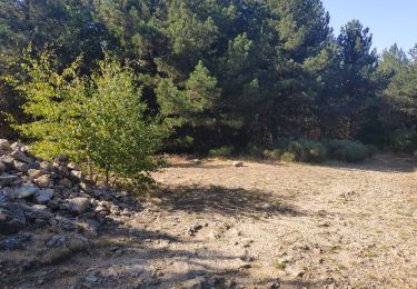
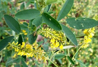
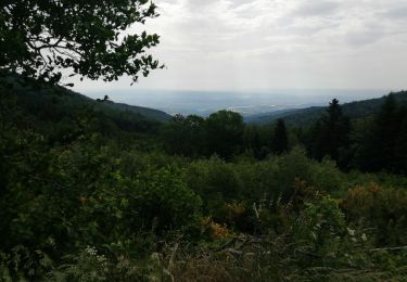
passage en forêts quasi tout le temps été
pause vers col de Grenouze
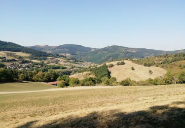
repas site envol de delta
passage grotte aux fées.
Attention chemin difficile à trouver au km 15.5
Positioning
Country:
France
Region :
Auvergne-Rhône-Alpes
Department/Province :
Loire
Municipality :
Chuyer
Location:
Unknown
Start:(Dec)
Start:(UTM)
632515 ; 5035312 (31T) N.
Comments
Trails nearby
![Trail Walking Chuyer - Autour du mont Ministre - Photo](https://media.geolcdn.com/t/375/260/ext.jpg?maxdim=2&url=https%3A%2F%2Fstatic1.geolcdn.com%2Fsiteimages%2Fupload%2Ffiles%2F1553511878bg_sport_marche.png)
![Walking Walking](https://static1.geolcdn.com/sitytour/trail-icons/101.png)
Autour du mont Ministre
Walking
Easy
(2)
Chuyer,
Auvergne-Rhône-Alpes,
Loire,
France
![](/images/other/stat-length.png)
7.5 km | 11.2 km-effort
Unknown
![](https://static1.geolcdn.com/siteimages/upload/files/16400158638029165_repeat_loop_refresh_sync_direction_icon.png)
Yes
![Trail Walking Pélussin - Randonnée du tacot à Pelussin - Photo](https://media.geolcdn.com/t/375/260/ext.jpg?maxdim=2&url=https%3A%2F%2Fmedia.geolcdn.com%2Ff%2F7e686509-b711-4cd0-bc14-adc2cf5f6ca7.jpg)
![Walking Walking](https://static1.geolcdn.com/sitytour/trail-icons/101.png)
Randonnée du tacot à Pelussin
Walking
Difficult
Pélussin,
Auvergne-Rhône-Alpes,
Loire,
France
![](/images/other/stat-length.png)
17.5 km | 26 km-effort
3h 55min
![](https://static1.geolcdn.com/siteimages/upload/files/16400158638029165_repeat_loop_refresh_sync_direction_icon.png)
No
![Trail Walking Longes - 1 septembre 2022 longes - Photo](https://media.geolcdn.com/t/375/260/ext.jpg?maxdim=2&url=https%3A%2F%2Fmedia.geolcdn.com%2Ff%2Fb8e593b2-5bab-42a8-9612-49feaf9d31d5.jpg)
![Walking Walking](https://static1.geolcdn.com/sitytour/trail-icons/101.png)
1 septembre 2022 longes
Walking
Difficult
Longes,
Auvergne-Rhône-Alpes,
Rhône,
France
![](/images/other/stat-length.png)
23 km | 35 km-effort
6h 40min
![](https://static1.geolcdn.com/siteimages/upload/files/16400158638029165_repeat_loop_refresh_sync_direction_icon.png)
Yes
![Trail Walking Sainte-Croix-en-Jarez - 42-ste-Croix-Jarez-12km-440m-mai22 - Photo](https://media.geolcdn.com/t/375/260/ext.jpg?maxdim=2&url=https%3A%2F%2Fmedia.geolcdn.com%2Ff%2F4e225a4d-cf8c-4893-9030-0d43b85a590b.jpg)
![Walking Walking](https://static1.geolcdn.com/sitytour/trail-icons/101.png)
42-ste-Croix-Jarez-12km-440m-mai22
Walking
Medium
Sainte-Croix-en-Jarez,
Auvergne-Rhône-Alpes,
Loire,
France
![](/images/other/stat-length.png)
12 km | 17.9 km-effort
3h 5min
![](https://static1.geolcdn.com/siteimages/upload/files/16400158638029165_repeat_loop_refresh_sync_direction_icon.png)
Yes
![Trail On foot La Chapelle-Villars - Pilat N°30: des «Côteaux à les Haies» - Photo](https://media.geolcdn.com/t/375/260/ext.jpg?maxdim=2&url=https%3A%2F%2Fmedia.geolcdn.com%2Ff%2Fdcae721c-56d2-4080-8395-c9b2db29b909.jpeg)
![On foot On foot](https://static1.geolcdn.com/sitytour/trail-icons/100.png)
Pilat N°30: des «Côteaux à les Haies»
On foot
Difficult
La Chapelle-Villars,
Auvergne-Rhône-Alpes,
Loire,
France
![](/images/other/stat-length.png)
29 km | 37 km-effort
8h 27min
![](https://static1.geolcdn.com/siteimages/upload/files/16400158638029165_repeat_loop_refresh_sync_direction_icon.png)
Yes
![Trail Walking Pélussin - 42 pelussin - Photo](https://media.geolcdn.com/t/375/260/ext.jpg?maxdim=2&url=https%3A%2F%2Fmedia.geolcdn.com%2Ff%2F2803f447-e16b-468d-b827-f0cbcd60ef5a.jpg)
![Walking Walking](https://static1.geolcdn.com/sitytour/trail-icons/101.png)
42 pelussin
Walking
Easy
Pélussin,
Auvergne-Rhône-Alpes,
Loire,
France
![](/images/other/stat-length.png)
14.5 km | 22 km-effort
5h 13min
![](https://static1.geolcdn.com/siteimages/upload/files/16400158638029165_repeat_loop_refresh_sync_direction_icon.png)
No
![Trail Walking Pélussin - 42-Croix-Montvieux-20km-630m-juin21 - Photo](https://media.geolcdn.com/t/375/260/ext.jpg?maxdim=2&url=https%3A%2F%2Fmedia.geolcdn.com%2Ff%2F20c1773f-9ba7-496a-98ab-580798c2bffd.jpg)
![Walking Walking](https://static1.geolcdn.com/sitytour/trail-icons/101.png)
42-Croix-Montvieux-20km-630m-juin21
Walking
Medium
Pélussin,
Auvergne-Rhône-Alpes,
Loire,
France
![](/images/other/stat-length.png)
20 km | 28 km-effort
5h 29min
![](https://static1.geolcdn.com/siteimages/upload/files/16400158638029165_repeat_loop_refresh_sync_direction_icon.png)
Yes
![Trail Walking Doizieux - 42 croix Montvieux collet de Doizieux 19km 650m - Photo](https://media.geolcdn.com/t/375/260/ext.jpg?maxdim=2&url=https%3A%2F%2Fmedia.geolcdn.com%2Ff%2Ffa909af6-2d36-4768-9cc3-571d8ef136f5.jpg)
![Walking Walking](https://static1.geolcdn.com/sitytour/trail-icons/101.png)
42 croix Montvieux collet de Doizieux 19km 650m
Walking
Easy
Doizieux,
Auvergne-Rhône-Alpes,
Loire,
France
![](/images/other/stat-length.png)
19 km | 28 km-effort
5h 42min
![](https://static1.geolcdn.com/siteimages/upload/files/16400158638029165_repeat_loop_refresh_sync_direction_icon.png)
Yes
![Trail Walking Pavezin - Crêt de Baronnette - Photo](https://media.geolcdn.com/t/375/260/ext.jpg?maxdim=2&url=https%3A%2F%2Fmedia.geolcdn.com%2Ff%2F2f4da85c-3fa3-4300-b643-85e7fca45333.jpg)
![Walking Walking](https://static1.geolcdn.com/sitytour/trail-icons/101.png)
Crêt de Baronnette
Walking
Easy
Pavezin,
Auvergne-Rhône-Alpes,
Loire,
France
![](/images/other/stat-length.png)
9.1 km | 13.6 km-effort
3h 20min
![](https://static1.geolcdn.com/siteimages/upload/files/16400158638029165_repeat_loop_refresh_sync_direction_icon.png)
Yes