


Ceillac-Les fours à chaux

griffet
User

Length
7.4 km

Max alt
1680 m

Uphill gradient
229 m
Km-Effort
10.5 km

Min alt
1537 m

Downhill gradient
222 m
Boucle
No
Creation date :
2022-07-07 13:12:51.0
Updated on :
2022-07-07 16:31:51.358
3h18
Difficulty : Easy

FREE GPS app for hiking
 SityTrail
IGN / Geographical institutes
SityTrail Plus
The world is yours!
About
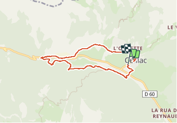
Trail Walking of 7.4 km to be discovered at Provence-Alpes-Côte d'Azur, Hautes-Alpes, Ceillac. This trail is proposed by griffet.
Description
Une belle balade pour un après-midi au frais dans les bois et au chaud du côté de la Viste
Positioning
Country:
France
Region :
Provence-Alpes-Côte d'Azur
Department/Province :
Hautes-Alpes
Municipality :
Ceillac
Location:
Unknown
Start:(Dec)
Start:(UTM)
323649 ; 4948390 (32T) N.
Comments