


Au pied des Aiguilles d'Arves

nicolas54230
User
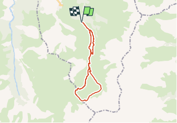

Length
11.7 km

Max alt
2591 m

Uphill gradient
701 m
Km-Effort
21 km

Min alt
1905 m

Downhill gradient
702 m
Boucle
Yes
Creation date :
2022-07-07 20:00:24.598
Updated on :
2022-07-07 20:02:21.598
4h46
Difficulty : Medium

FREE GPS app for hiking
 SityTrail
IGN / Geographical institutes
SityTrail Plus
The world is yours!
About
Trail On foot of 11.7 km to be discovered at Auvergne-Rhône-Alpes, Savoy, Albiez-Montrond. This trail is proposed by nicolas54230.
Positioning
Country:
France
Region :
Auvergne-Rhône-Alpes
Department/Province :
Savoy
Municipality :
Albiez-Montrond
Location:
Unknown
Start:(Dec)
Start:(UTM)
290346 ; 5006099 (32T) N.
Comments