


le bez col du pendu

raab
User
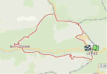

Length
11.7 km

Max alt
1438 m

Uphill gradient
390 m
Km-Effort
16.9 km

Min alt
1080 m

Downhill gradient
392 m
Boucle
Yes
Creation date :
2022-07-07 07:18:54.956
Updated on :
2022-07-08 05:47:57.83
5h30
Difficulty : Difficult

FREE GPS app for hiking
 SityTrail
IGN / Geographical institutes
SityTrail Plus
The world is yours!
About
Trail Walking of 11.7 km to be discovered at Auvergne-Rhône-Alpes, Ardèche, Saint-Étienne-de-Lugdarès. This trail is proposed by raab.
Positioning
Country:
France
Region :
Auvergne-Rhône-Alpes
Department/Province :
Ardèche
Municipality :
Saint-Étienne-de-Lugdarès
Location:
Unknown
Start:(Dec)
Start:(UTM)
583321 ; 4943267 (31T) N.
Comments