


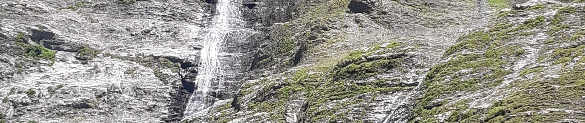
cirsue du fer à cheval jusqu´au bout du monde . montée rive gauche, descente rive droite

stef789
User GUIDE
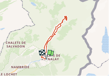

Length
13.4 km

Max alt
1315 m

Uphill gradient
645 m
Km-Effort
22 km

Min alt
949 m

Downhill gradient
647 m
Boucle
Yes
Creation date :
2022-07-08 11:16:22.198
Updated on :
2022-07-08 16:23:21.125
4h34
Difficulty : Medium

FREE GPS app for hiking
 SityTrail
IGN / Geographical institutes
SityTrail Plus
The world is yours!
About
Trail Walking of 13.4 km to be discovered at Auvergne-Rhône-Alpes, Upper Savoy, Sixt-Fer-à-Cheval. This trail is proposed by stef789.
Photos


26 photos in total. Please click on a photo to see them all in the gallery.
Positioning
Country:
France
Region :
Auvergne-Rhône-Alpes
Department/Province :
Upper Savoy
Municipality :
Sixt-Fer-à-Cheval
Location:
Unknown
Start:(Dec)
Start:(UTM)
333062 ; 5104858 (32T) N.
Comments