


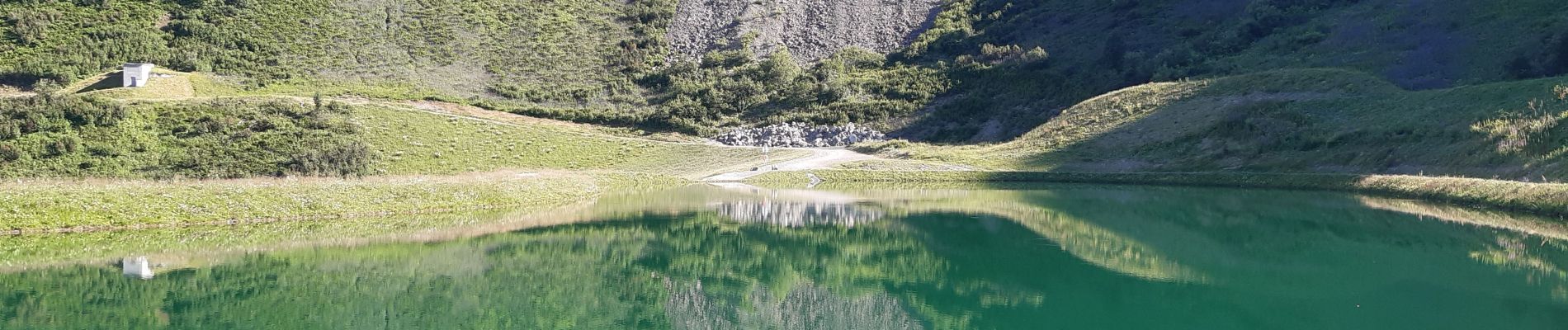
plateau des saix . la corne . les biollaires . pointe de cupoire . plateau des saix

stef789
User GUIDE
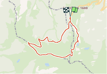

Length
8.5 km

Max alt
1982 m

Uphill gradient
497 m
Km-Effort
15.1 km

Min alt
1548 m

Downhill gradient
498 m
Boucle
Yes
Creation date :
2022-07-09 12:49:44.497
Updated on :
2022-07-09 16:46:19.508
3h54
Difficulty : Medium

FREE GPS app for hiking
 SityTrail
IGN / Geographical institutes
SityTrail Plus
The world is yours!
About
Trail Walking of 8.5 km to be discovered at Auvergne-Rhône-Alpes, Upper Savoy, Samoëns. This trail is proposed by stef789.
Photos


Positioning
Country:
France
Region :
Auvergne-Rhône-Alpes
Department/Province :
Upper Savoy
Municipality :
Samoëns
Location:
Unknown
Start:(Dec)
Start:(UTM)
321720 ; 5102154 (32T) N.
Comments