


Pic nic

audrey54
User
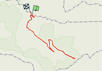

Length
11.1 km

Max alt
638 m

Uphill gradient
262 m
Km-Effort
14.6 km

Min alt
366 m

Downhill gradient
289 m
Boucle
Yes
Creation date :
2022-07-03 07:36:02.0
Updated on :
2022-07-10 07:51:17.361
3h06
Difficulty : Unknown

FREE GPS app for hiking
 SityTrail
IGN / Geographical institutes
SityTrail Plus
The world is yours!
About
Trail Walking of 11.1 km to be discovered at Grand Est, Meurthe-et-Moselle, Saint-Sauveur. This trail is proposed by audrey54.
Positioning
Country:
France
Region :
Grand Est
Department/Province :
Meurthe-et-Moselle
Municipality :
Saint-Sauveur
Location:
Unknown
Start:(Dec)
Start:(UTM)
353255 ; 5376777 (32U) N.
Comments