


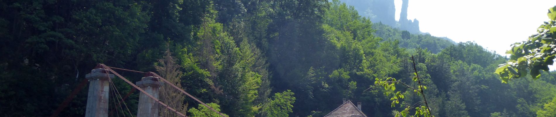
Sentier-du-Cheran-2019-09-04

Valmeinier
User
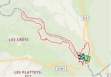

Length
6.2 km

Max alt
590 m

Uphill gradient
266 m
Km-Effort
9.8 km

Min alt
431 m

Downhill gradient
277 m
Boucle
Yes
Creation date :
2022-07-10 11:58:38.021
Updated on :
2022-07-10 12:20:41.922
2h13
Difficulty : Medium

FREE GPS app for hiking
 SityTrail
IGN / Geographical institutes
SityTrail Plus
The world is yours!
About
Trail Walking of 6.2 km to be discovered at Auvergne-Rhône-Alpes, Upper Savoy, Cusy. This trail is proposed by Valmeinier.
Photos


Positioning
Country:
France
Region :
Auvergne-Rhône-Alpes
Department/Province :
Upper Savoy
Municipality :
Cusy
Location:
Unknown
Start:(Dec)
Start:(UTM)
271035 ; 5072046 (32T) N.
Comments
très belle balade, avec une remontée très raide en fin de parcours, mais ça vaut le détour.