


le segala

Dupuybadonniere
User

Length
8 km

Max alt
697 m

Uphill gradient
202 m
Km-Effort
10.8 km

Min alt
542 m

Downhill gradient
210 m
Boucle
Yes
Creation date :
2022-07-12 07:43:44.353
Updated on :
2022-07-12 10:19:55.847
2h04
Difficulty : Medium

FREE GPS app for hiking
 SityTrail
IGN / Geographical institutes
SityTrail Plus
The world is yours!
About
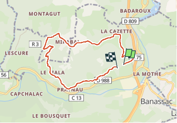
Trail Walking of 8 km to be discovered at Occitania, Lozère, Banassac-Canilhac. This trail is proposed by Dupuybadonniere.
Positioning
Country:
France
Region :
Occitania
Department/Province :
Lozère
Municipality :
Banassac-Canilhac
Location:
Banassac
Start:(Dec)
Start:(UTM)
515124 ; 4921183 (31T) N.
Comments