


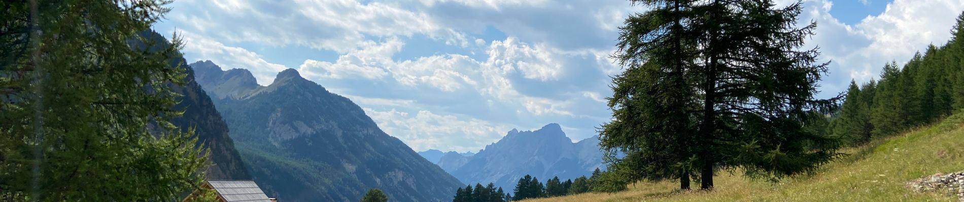
Ceillac-la Riaille - Chaurionde

griffet
User
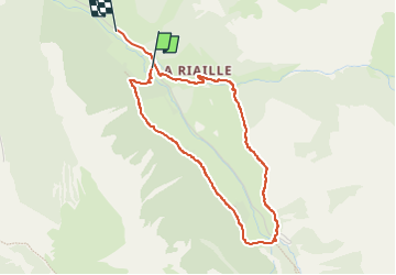

Length
4.1 km

Max alt
1988 m

Uphill gradient
128 m
Km-Effort
5.9 km

Min alt
1855 m

Downhill gradient
168 m
Boucle
No
Creation date :
2022-07-14 13:41:17.0
Updated on :
2022-07-14 15:43:49.388
2h02
Difficulty : Easy

FREE GPS app for hiking
 SityTrail
IGN / Geographical institutes
SityTrail Plus
The world is yours!
About
Trail Walking of 4.1 km to be discovered at Provence-Alpes-Côte d'Azur, Hautes-Alpes, Ceillac. This trail is proposed by griffet.
Description
Petit tour facile
Photos

Positioning
Country:
France
Region :
Provence-Alpes-Côte d'Azur
Department/Province :
Hautes-Alpes
Municipality :
Ceillac
Location:
Unknown
Start:(Dec)
Start:(UTM)
326458 ; 4945175 (32T) N.
Comments