


PR1 Molieres a l envers

Glurps
User
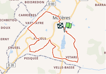

Length
9.8 km

Max alt
184 m

Uphill gradient
267 m
Km-Effort
13.4 km

Min alt
106 m

Downhill gradient
268 m
Boucle
Yes
Creation date :
2022-07-16 06:02:37.0
Updated on :
2022-07-16 08:34:30.145
2h31
Difficulty : Easy

FREE GPS app for hiking
 SityTrail
IGN / Geographical institutes
SityTrail Plus
The world is yours!
About
Trail Walking of 9.8 km to be discovered at Occitania, Tarn-et-Garonne, Molières. This trail is proposed by Glurps.
Positioning
Country:
France
Region :
Occitania
Department/Province :
Tarn-et-Garonne
Municipality :
Molières
Location:
Unknown
Start:(Dec)
Start:(UTM)
369394 ; 4894073 (31T) N.
Comments