


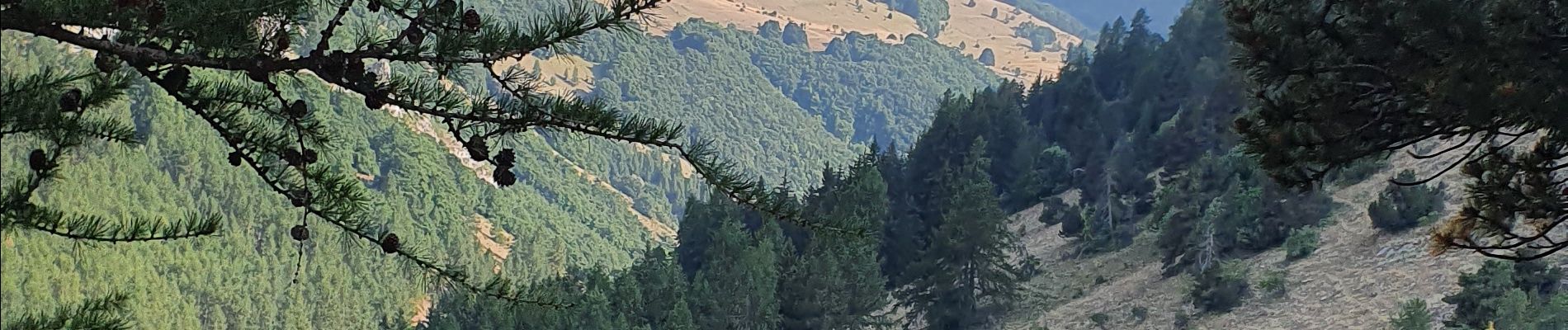
Col de Gleizé - Chaudun via route forestière

kurt-vh
User
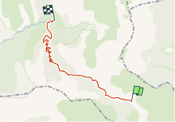

Length
5.9 km

Max alt
1740 m

Uphill gradient
44 m
Km-Effort
7.7 km

Min alt
1319 m

Downhill gradient
424 m
Boucle
No
Creation date :
2022-07-17 07:31:36.088
Updated on :
2023-02-05 09:49:55.597
1h45
Difficulty : Medium

FREE GPS app for hiking
 SityTrail
IGN / Geographical institutes
SityTrail Plus
The world is yours!
About
Trail Walking of 5.9 km to be discovered at Provence-Alpes-Côte d'Azur, Hautes-Alpes, Gap. This trail is proposed by kurt-vh.
Photos


Positioning
Country:
France
Region :
Provence-Alpes-Côte d'Azur
Department/Province :
Hautes-Alpes
Municipality :
Gap
Location:
Gap
Start:(Dec)
Start:(UTM)
265809 ; 4945266 (32T) N.
Comments