


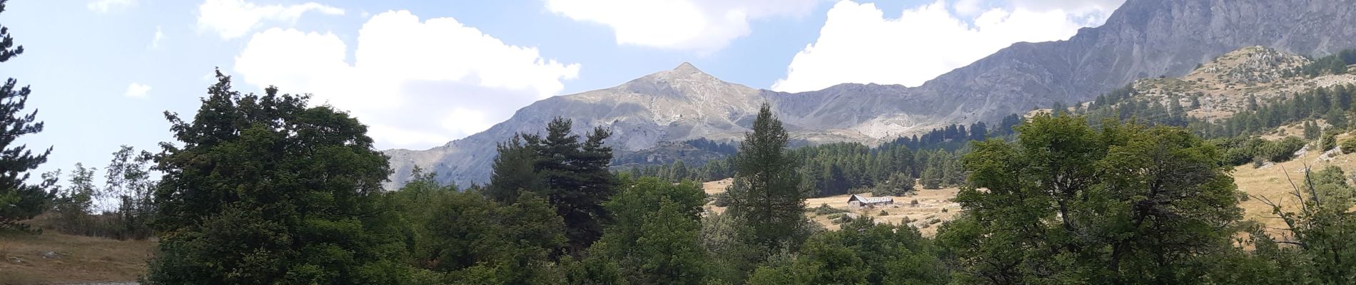
au dessus de Chorges : Naume Raze . les Drayes . parking des Gardes . Forest Barthiers . Naume Raze

stef789
User GUIDE
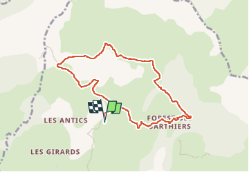

Length
9.3 km

Max alt
1780 m

Uphill gradient
419 m
Km-Effort
14.9 km

Min alt
1455 m

Downhill gradient
415 m
Boucle
Yes
Creation date :
2022-07-20 09:33:47.311
Updated on :
2022-07-20 14:34:47.535
4h13
Difficulty : Medium

FREE GPS app for hiking
 SityTrail
IGN / Geographical institutes
SityTrail Plus
The world is yours!
About
Trail Walking of 9.3 km to be discovered at Provence-Alpes-Côte d'Azur, Hautes-Alpes, Chorges. This trail is proposed by stef789.
Photos


21 photos in total. Please click on a photo to see them all in the gallery.
Positioning
Country:
France
Region :
Provence-Alpes-Côte d'Azur
Department/Province :
Hautes-Alpes
Municipality :
Chorges
Location:
Unknown
Start:(Dec)
Start:(UTM)
283914 ; 4939528 (32T) N.
Comments