


Romedennes GB 2022

fra_depoorter
User
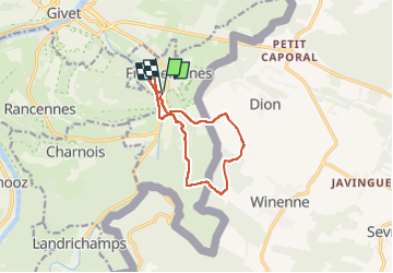

Length
9.2 km

Max alt
314 m

Uphill gradient
260 m
Km-Effort
12.7 km

Min alt
109 m

Downhill gradient
259 m
Boucle
Yes
Creation date :
2022-07-21 11:59:49.478
Updated on :
2022-07-21 16:37:34.706
2h21
Difficulty : Difficult

FREE GPS app for hiking
 SityTrail
IGN / Geographical institutes
SityTrail Plus
The world is yours!
About
Trail Walking of 9.2 km to be discovered at Grand Est, Ardennes, Fromelennes. This trail is proposed by fra_depoorter.
Description
Marche Eneo Beauraing
Positioning
Country:
France
Region :
Grand Est
Department/Province :
Ardennes
Municipality :
Fromelennes
Location:
Unknown
Start:(Dec)
Start:(UTM)
632706 ; 5553595 (31U) N.
Comments