


Menestreau en villette_Sud

lemuid
User
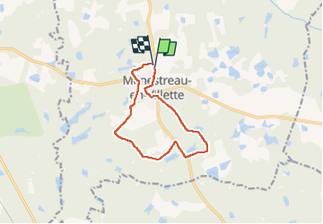

Length
10 km

Max alt
133 m

Uphill gradient
81 m
Km-Effort
11.1 km

Min alt
112 m

Downhill gradient
81 m
Boucle
Yes
Creation date :
2022-07-22 07:18:14.2
Updated on :
2022-07-22 11:47:33.136
1h57
Difficulty : Very easy

FREE GPS app for hiking
 SityTrail
IGN / Geographical institutes
SityTrail Plus
The world is yours!
About
Trail Walking of 10 km to be discovered at Centre-Loire Valley, Loiret, Ménestreau-en-Villette. This trail is proposed by lemuid.
Positioning
Country:
France
Region :
Centre-Loire Valley
Department/Province :
Loiret
Municipality :
Ménestreau-en-Villette
Location:
Unknown
Start:(Dec)
Start:(UTM)
426664 ; 5284059 (31T) N.
Comments