


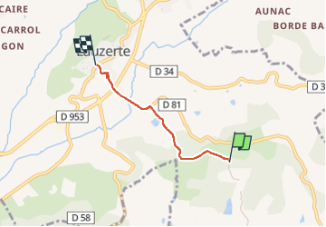
St sernin lauzerte

Glurps
User

Length
3.2 km

Max alt
231 m

Uphill gradient
113 m
Km-Effort
4.7 km

Min alt
101 m

Downhill gradient
128 m
Boucle
No
Creation date :
2022-07-22 11:04:06.0
Updated on :
2022-07-22 11:50:49.124
46m
Difficulty : Easy

FREE GPS app for hiking
 SityTrail
IGN / Geographical institutes
SityTrail Plus
The world is yours!
About
Trail Walking of 3.2 km to be discovered at Occitania, Tarn-et-Garonne, Lauzerte. This trail is proposed by Glurps.
Positioning
Country:
France
Region :
Occitania
Department/Province :
Tarn-et-Garonne
Municipality :
Lauzerte
Location:
Unknown
Start:(Dec)
Start:(UTM)
353274 ; 4900323 (31T) N.
Comments