


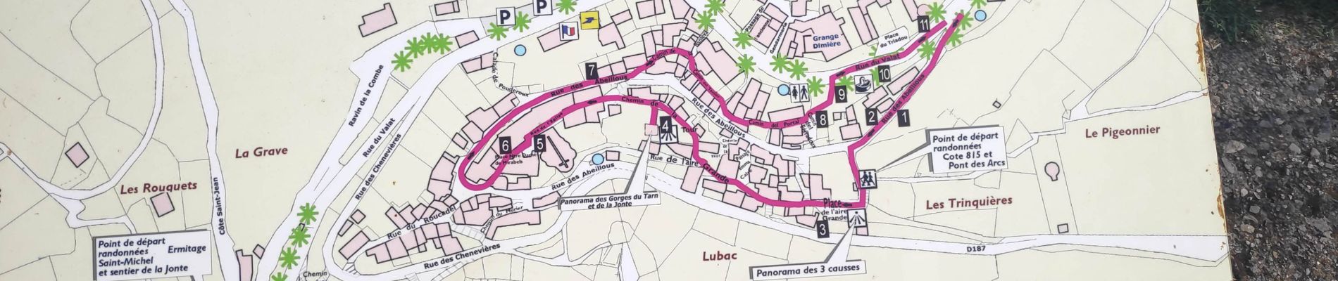
balade a Peyreleau

gdela
User
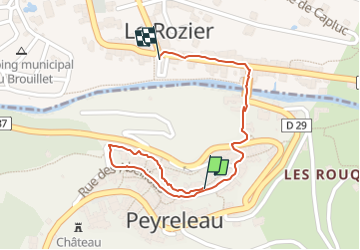

Length
900 m

Max alt
437 m

Uphill gradient
5 m
Km-Effort
1.1 km

Min alt
396 m

Downhill gradient
38 m
Boucle
No
Creation date :
2022-07-22 15:31:01.111
Updated on :
2022-07-23 14:28:05.17
20m
Difficulty : Easy

FREE GPS app for hiking
 SityTrail
IGN / Geographical institutes
SityTrail Plus
The world is yours!
About
Trail Walking of 900 m to be discovered at Occitania, Aveyron, Peyreleau. This trail is proposed by gdela.
Photos

Positioning
Country:
France
Region :
Occitania
Department/Province :
Aveyron
Municipality :
Peyreleau
Location:
Unknown
Start:(Dec)
Start:(UTM)
516672 ; 4892842 (31T) N.
Comments