


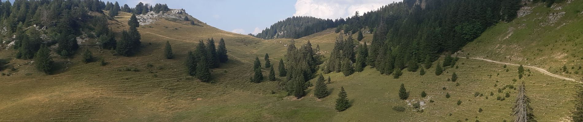
refuge Patmelan via anglettaz . gd glacière . fontaine du tour . grotte de l enfer / retour via gd montoir et pt montoir

stef789
User GUIDE
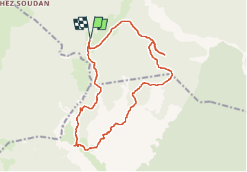

Length
10.2 km

Max alt
1820 m

Uphill gradient
444 m
Km-Effort
16.1 km

Min alt
1490 m

Downhill gradient
444 m
Boucle
Yes
Creation date :
2022-07-23 10:29:19.515
Updated on :
2022-07-23 18:44:30.377
6h01
Difficulty : Medium

FREE GPS app for hiking
 SityTrail
IGN / Geographical institutes
SityTrail Plus
The world is yours!
About
Trail Walking of 10.2 km to be discovered at Auvergne-Rhône-Alpes, Upper Savoy, Fillière. This trail is proposed by stef789.
Description
piste pour arriver en voiture dénoncée attention. la randonnée pas fatiguante mais un peu cassante pour les jambes
Photos


24 photos in total. Please click on a photo to see them all in the gallery.
Positioning
Country:
France
Region :
Auvergne-Rhône-Alpes
Department/Province :
Upper Savoy
Municipality :
Fillière
Location:
Aviernoz
Start:(Dec)
Start:(UTM)
286440 ; 5093763 (32T) N.
Comments