


Cognin les gorges 2

raygautier
User
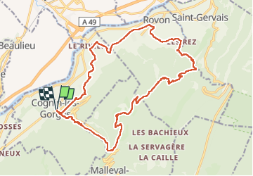

Length
23 km

Max alt
984 m

Uphill gradient
975 m
Km-Effort
36 km

Min alt
212 m

Downhill gradient
976 m
Boucle
Yes
Creation date :
2022-07-24 06:50:53.0
Updated on :
2022-07-24 18:43:32.727
9h56
Difficulty : Very difficult

FREE GPS app for hiking
 SityTrail
IGN / Geographical institutes
SityTrail Plus
The world is yours!
About
Trail Walking of 23 km to be discovered at Auvergne-Rhône-Alpes, Isère, Cognin-les-Gorges. This trail is proposed by raygautier.
Description
Jolie balade
Positioning
Country:
France
Region :
Auvergne-Rhône-Alpes
Department/Province :
Isère
Municipality :
Cognin-les-Gorges
Location:
Unknown
Start:(Dec)
Start:(UTM)
689557 ; 5004743 (31T) N.
Comments