


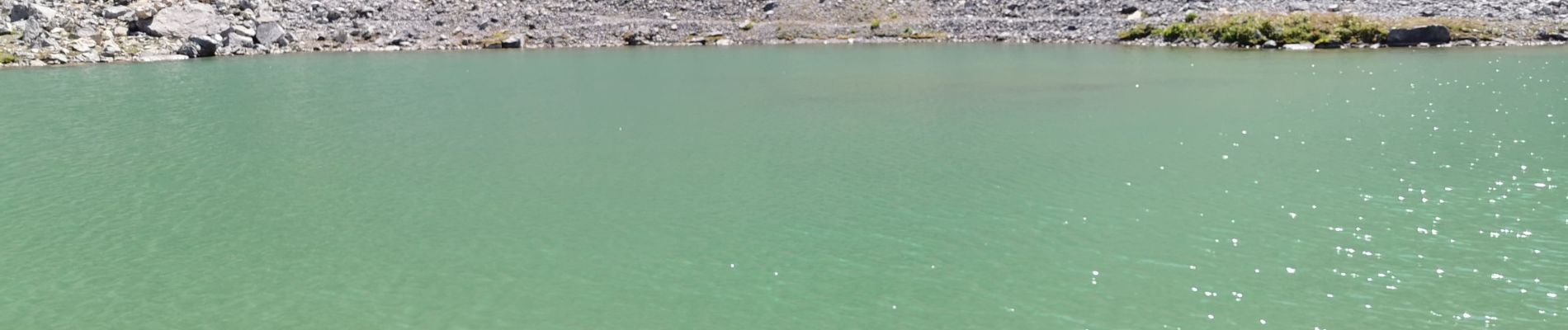
Le pont de l'alpe/ réf les Drayeres

dansanet
User
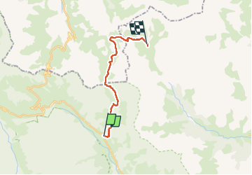

Length
16.4 km

Max alt
2611 m

Uphill gradient
1131 m
Km-Effort
30 km

Min alt
1711 m

Downhill gradient
653 m
Boucle
No
Creation date :
2022-07-24 05:59:30.407
Updated on :
2022-07-25 08:30:51.524
7h45
Difficulty : Difficult

FREE GPS app for hiking
 SityTrail
IGN / Geographical institutes
SityTrail Plus
The world is yours!
About
Trail Walking of 16.4 km to be discovered at Provence-Alpes-Côte d'Azur, Hautes-Alpes, Le Monêtier-les-Bains. This trail is proposed by dansanet.
Photos


Positioning
Country:
France
Region :
Provence-Alpes-Côte d'Azur
Department/Province :
Hautes-Alpes
Municipality :
Le Monêtier-les-Bains
Location:
Unknown
Start:(Dec)
Start:(UTM)
300228 ; 4988167 (32T) N.
Comments