


L'Antonyenne

c.chehere
User
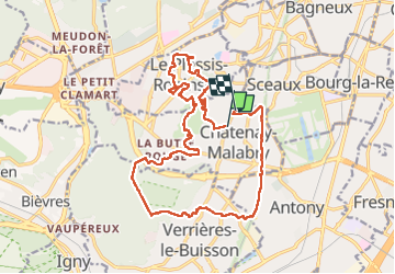

Length
19.3 km

Max alt
181 m

Uphill gradient
282 m
Km-Effort
23 km

Min alt
73 m

Downhill gradient
292 m
Boucle
No
Creation date :
2022-07-25 05:36:57.36
Updated on :
2022-07-27 08:36:58.408
4h46
Difficulty : Medium

FREE GPS app for hiking
 SityTrail
IGN / Geographical institutes
SityTrail Plus
The world is yours!
About
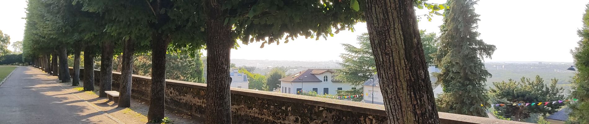
Trail Walking of 19.3 km to be discovered at Ile-de-France, Hauts-de-Seine, Châtenay-Malabry. This trail is proposed by c.chehere.
Photos


Positioning
Country:
France
Region :
Ile-de-France
Department/Province :
Hauts-de-Seine
Municipality :
Châtenay-Malabry
Location:
Unknown
Start:(Dec)
Start:(UTM)
446648 ; 5402156 (31U) N.
Comments