


Adeps_Rulles2014

gue
User
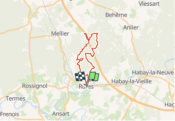

Length
20 km

Max alt
479 m

Uphill gradient
361 m
Km-Effort
25 km

Min alt
343 m

Downhill gradient
361 m
Boucle
Yes
Creation date :
2014-12-10 00:00:00.0
Updated on :
2014-12-10 00:00:00.0
5h32
Difficulty : Unknown

FREE GPS app for hiking
 SityTrail
IGN / Geographical institutes
SityTrail Plus
The world is yours!
About
Trail Walking of 20 km to be discovered at Wallonia, Luxembourg, Habay. This trail is proposed by gue.
Positioning
Country:
Belgium
Region :
Wallonia
Department/Province :
Luxembourg
Municipality :
Habay
Location:
Rulles
Start:(Dec)
Start:(UTM)
684526 ; 5510321 (31U) N.
Comments