


Sarrasins (arche des)

Patricelecerf
User
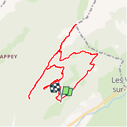

Length
12.2 km

Max alt
1606 m

Uphill gradient
832 m
Km-Effort
23 km

Min alt
907 m

Downhill gradient
825 m
Boucle
Yes
Creation date :
2016-07-31 00:00:00.0
Updated on :
2016-07-31 00:00:00.0
7h05
Difficulty : Medium

FREE GPS app for hiking
 SityTrail
IGN / Geographical institutes
SityTrail Plus
The world is yours!
About
Trail Walking of 12.2 km to be discovered at Auvergne-Rhône-Alpes, Upper Savoy, Thônes. This trail is proposed by Patricelecerf.
Description
11.08.14
Positioning
Country:
France
Region :
Auvergne-Rhône-Alpes
Department/Province :
Upper Savoy
Municipality :
Thônes
Location:
Unknown
Start:(Dec)
Start:(UTM)
293415 ; 5086466 (32T) N.
Comments
Magnifique Beau regard.