


Vent des forêts

lorenzot54
User
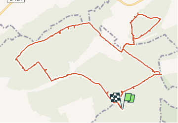

Length
16 km

Max alt
345 m

Uphill gradient
191 m
Km-Effort
18.6 km

Min alt
271 m

Downhill gradient
189 m
Boucle
Yes
Creation date :
2022-07-27 11:26:42.0
Updated on :
2022-07-27 16:16:09.408
2h36
Difficulty : Easy

FREE GPS app for hiking
 SityTrail
IGN / Geographical institutes
SityTrail Plus
The world is yours!
About
Trail Mountain bike of 16 km to be discovered at Grand Est, Meuse, Nicey-sur-Aire. This trail is proposed by lorenzot54.
Positioning
Country:
France
Region :
Grand Est
Department/Province :
Meuse
Municipality :
Nicey-sur-Aire
Location:
Unknown
Start:(Dec)
Start:(UTM)
674908 ; 5419972 (31U) N.
Comments