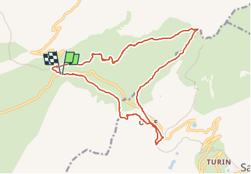
Saint Jean d'Arves-Boucle Glandon/Croix de Fer

nicolas54230
User

Length
9.7 km

Max alt
2245 m

Uphill gradient
440 m
Km-Effort
15.6 km

Min alt
1890 m

Downhill gradient
428 m
Boucle
Yes
Creation date :
2022-07-29 10:53:52.56
Updated on :
2022-07-29 10:55:20.692
3h32
Difficulty : Difficult

FREE GPS app for hiking
 SityTrail
IGN / Geographical institutes
SityTrail Plus
The world is yours!
About
Trail Walking of 9.7 km to be discovered at Auvergne-Rhône-Alpes, Savoy, Saint-Colomban-des-Villards. This trail is proposed by nicolas54230.
Positioning
Country:
France
Region :
Auvergne-Rhône-Alpes
Department/Province :
Savoy
Municipality :
Saint-Colomban-des-Villards
Location:
Unknown
Start:(Dec)
Start:(UTM)
278497 ; 5013349 (32T) N.
Comments