


a goussaincourt

mannequ1
User
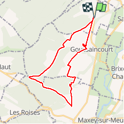

Length
14.6 km

Max alt
413 m

Uphill gradient
233 m
Km-Effort
17.7 km

Min alt
270 m

Downhill gradient
233 m
Boucle
Yes
Creation date :
2014-12-10 00:00:00.0
Updated on :
2014-12-10 00:00:00.0
3h51
Difficulty : Easy

FREE GPS app for hiking
 SityTrail
IGN / Geographical institutes
SityTrail Plus
The world is yours!
About
Trail Walking of 14.6 km to be discovered at Grand Est, Meuse, Burey-la-Côte. This trail is proposed by mannequ1.
Positioning
Country:
France
Region :
Grand Est
Department/Province :
Meuse
Municipality :
Burey-la-Côte
Location:
Unknown
Start:(Dec)
Start:(UTM)
698817 ; 5375349 (31U) N.
Comments