


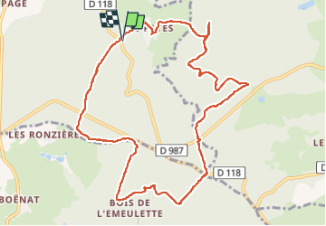
les Fayes a/r 17-7-2022

RenaudCandottiBesson
User

Length
12.1 km

Max alt
609 m

Uphill gradient
201 m
Km-Effort
14.8 km

Min alt
491 m

Downhill gradient
200 m
Boucle
Yes
Creation date :
2022-07-17 13:21:05.912
Updated on :
2022-07-31 12:48:50.089
3h02
Difficulty : Difficult

FREE GPS app for hiking
 SityTrail
IGN / Geographical institutes
SityTrail Plus
The world is yours!
About
Trail Walking of 12.1 km to be discovered at Auvergne-Rhône-Alpes, Allier, Coutansouze. This trail is proposed by RenaudCandottiBesson.
Positioning
Country:
France
Region :
Auvergne-Rhône-Alpes
Department/Province :
Allier
Municipality :
Coutansouze
Location:
Unknown
Start:(Dec)
Start:(UTM)
501140 ; 5116325 (31T) N.
Comments