Trail On foot Curienne - Terneze -2 - Photo

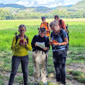
Une équipe à votre service garant de convivialité et bonne humeur
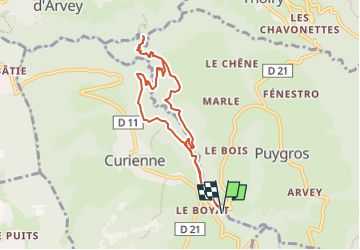
© OpenStreetMap contributors
Length
Length
8.2 km
Max alt
Max alt
649 m
Uphill gradient
Uphill gradient
387 m
Km-Effort
Km-Effort  
13.4 km
Min alt
Min alt
429 m
Downhill gradient
Downhill gradient
388 m
Boucle
Boucle
Yes
Creation date :
2022-08-03 12:45:28.289
Updated on :
2022-08-03 12:45:28.289

(0 Reviews)

On foot
On foot
3h02
Difficulty : Easy

Scan this QR Code to open this trail in the SityTrail application

FREE GPS app for hiking

Logo SityTrail SityTrail

IGN / Geographical institutes

Download SityTrail from the App Store Download SityTrail from Google Play

Logo SityTrail SityTrail Plus

The world is yours!

Download SityTrail from the App Store Download SityTrail from Google Play Download SityTrail on Huawei AppGallery

About

Trail On foot of 8.2 km to be discovered at Auvergne-Rhône-Alpes, Savoy, Curienne. This trail is proposed by mini balades Adapar.

Elevation profile

Points of interest

Point of interest Curienne - Parking pont du Boyat - Photo
jljacquin
Point of interest Curienne - Passerelle du - Photo
jljacquin
CURIENNE 
Point of interest Puygros - Patte d'oie - Photo
jljacquin
PUYGROS 
Point of interest Saint-Jean-d'Arvey - Point de vue sur le Trou de l'Enfer - Photo
jljacquin
SAINT-JEAN-D'ARVEY 
Point of interest Puygros - Pont sur la - Photo
jljacquin
PUYGROS 
Point of interest Curienne - Patte d'oie - Photo
jljacquin
CURIENNE 
Point of interest Curienne - Croisement de la boucle - Photo
jljacquin
Point of interest Curienne - Canyon de Ternèze - Photo
jljacquin
Point of interest Curienne - Parking pont du Boyat - Photo
jljacquin

Positioning

Country:
France
Region :
Auvergne-Rhône-Alpes
Department/Province :
Savoy
Municipality :
Curienne
Location:
Unknown
Start:(UTM)
267764 ; 5049469 (32T) N.


Close
My subscriptions