


Reix-Champegaud

csy95
User
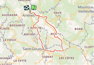

Length
15.3 km

Max alt
638 m

Uphill gradient
328 m
Km-Effort
19.7 km

Min alt
402 m

Downhill gradient
327 m
Boucle
Yes
Creation date :
2018-08-26 10:57:56.437
Updated on :
2018-08-26 10:57:56.558
3h20
Difficulty : Medium

FREE GPS app for hiking
 SityTrail
IGN / Geographical institutes
SityTrail Plus
The world is yours!
About
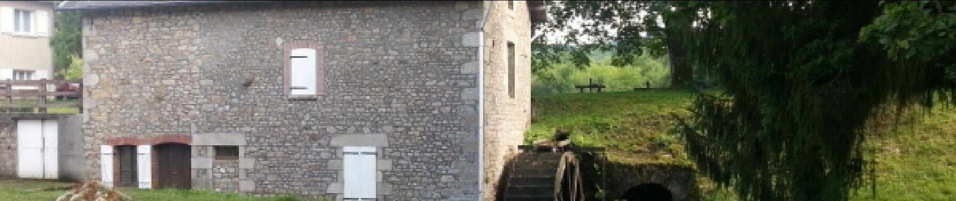
Trail Walking of 15.3 km to be discovered at New Aquitaine, Creuse, Arrènes. This trail is proposed by csy95.
Photos


Positioning
Country:
France
Region :
New Aquitaine
Department/Province :
Creuse
Municipality :
Arrènes
Location:
Unknown
Start:(Dec)
Start:(UTM)
389542 ; 5103138 (31T) N.
Comments