


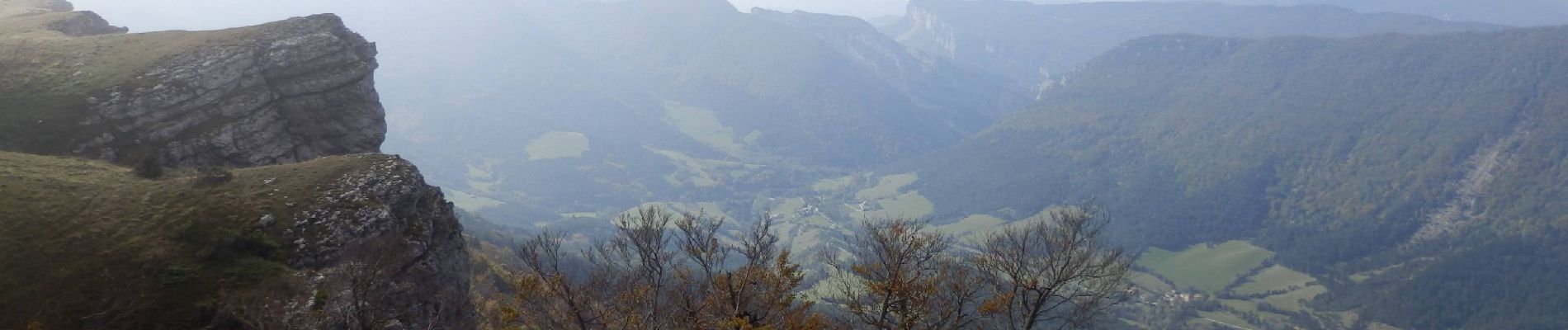
Plateau d_Ambel 15km

thonyc
User GUIDE

Length
14.8 km

Max alt
1501 m

Uphill gradient
521 m
Km-Effort
22 km

Min alt
1138 m

Downhill gradient
521 m
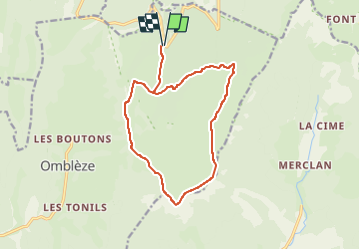
Boucle
Yes
Creation date :
2022-08-05 15:40:03.475
Updated on :
2022-08-08 06:25:41.601
4h20
Difficulty : Medium

FREE GPS app for hiking
 SityTrail
IGN / Geographical institutes
SityTrail Plus
The world is yours!
About
Trail Walking of 14.8 km to be discovered at Auvergne-Rhône-Alpes, Drôme, Omblèze. This trail is proposed by thonyc.
Photos


Positioning
Country:
France
Region :
Auvergne-Rhône-Alpes
Department/Province :
Drôme
Municipality :
Omblèze
Location:
Unknown
Start:(Dec)
Start:(UTM)
677927 ; 4973487 (31T) N.
Comments