


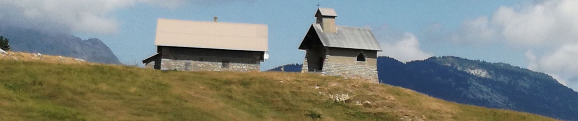
Notre Dame des Neiges

Jean-Paulchoux
User
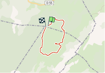

Length
5.6 km

Max alt
1498 m

Uphill gradient
145 m
Km-Effort
7.5 km

Min alt
1406 m

Downhill gradient
140 m
Boucle
Yes
Creation date :
2022-08-06 08:39:07.015
Updated on :
2022-08-06 13:56:27.314
3h33
Difficulty : Very easy

FREE GPS app for hiking
 SityTrail
IGN / Geographical institutes
SityTrail Plus
The world is yours!
About
Trail Walking of 5.6 km to be discovered at Auvergne-Rhône-Alpes, Upper Savoy, Fillière. This trail is proposed by Jean-Paulchoux.
Photos


Positioning
Country:
France
Region :
Auvergne-Rhône-Alpes
Department/Province :
Upper Savoy
Municipality :
Fillière
Location:
Thorens-Glières
Start:(Dec)
Start:(UTM)
292028 ; 5091804 (32T) N.
Comments