


oli40 j1 banyuls - source massane

stef789
User GUIDE

Length
13.6 km

Max alt
973 m

Uphill gradient
1130 m
Km-Effort
25 km

Min alt
4 m

Downhill gradient
167 m
Boucle
No
Creation date :
2022-08-07 10:01:07.638
Updated on :
2022-08-07 10:03:04.087
5h46
Difficulty : Very difficult

FREE GPS app for hiking
 SityTrail
IGN / Geographical institutes
SityTrail Plus
The world is yours!
About
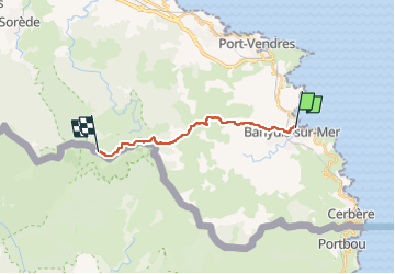
Trail Walking of 13.6 km to be discovered at Occitania, Pyrénées-Orientales, Banyuls-sur-Mer. This trail is proposed by stef789.
Positioning
Country:
France
Region :
Occitania
Department/Province :
Pyrénées-Orientales
Municipality :
Banyuls-sur-Mer
Location:
Unknown
Start:(Dec)
Start:(UTM)
510648 ; 4703243 (31T) N.
Comments