


Pierre arnoux

guariso
User
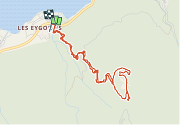

Length
6.3 km

Max alt
1300 m

Uphill gradient
497 m
Km-Effort
13 km

Min alt
805 m

Downhill gradient
504 m
Boucle
Yes
Creation date :
2022-08-11 10:11:18.167
Updated on :
2022-08-11 14:53:15.745
3h19
Difficulty : Difficult

FREE GPS app for hiking
 SityTrail
IGN / Geographical institutes
SityTrail Plus
The world is yours!
About
Trail Walking of 6.3 km to be discovered at Provence-Alpes-Côte d'Azur, Hautes-Alpes, Savines-le-Lac. This trail is proposed by guariso.
Description
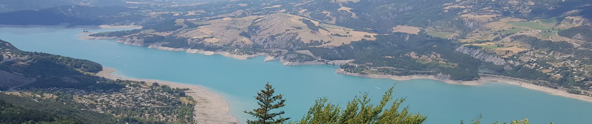
ballade assez difficile, partant du camping municipal de savines le lac.
jolie vue a l'arrivée et possibilité de pique nique (tables, bbq en dur)
accès possible en voiture.
Photos

Positioning
Country:
France
Region :
Provence-Alpes-Côte d'Azur
Department/Province :
Hautes-Alpes
Municipality :
Savines-le-Lac
Location:
Unknown
Start:(Dec)
Start:(UTM)
292308 ; 4932765 (32T) N.
Comments