


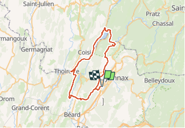
Bellignat Chancia Thoirette et Izernore

cailloux54
User

Length
51 km

Max alt
696 m

Uphill gradient
1021 m
Km-Effort
65 km

Min alt
287 m

Downhill gradient
1021 m
Boucle
Yes
Creation date :
2022-08-12 06:54:17.771
Updated on :
2022-08-12 09:44:06.084
2h16
Difficulty : Medium

FREE GPS app for hiking
 SityTrail
IGN / Geographical institutes
SityTrail Plus
The world is yours!
About
Trail Electric bike of 51 km to be discovered at Auvergne-Rhône-Alpes, Ain, Bellignat. This trail is proposed by cailloux54.
Positioning
Country:
France
Region :
Auvergne-Rhône-Alpes
Department/Province :
Ain
Municipality :
Bellignat
Location:
Unknown
Start:(Dec)
Start:(UTM)
702361 ; 5124162 (31T) N.
Comments