


garg2

Frings
User
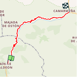

Length
12.7 km

Max alt
591 m

Uphill gradient
1356 m
Km-Effort
32 km

Min alt
212 m

Downhill gradient
1636 m
Boucle
No
Creation date :
2014-12-10 00:00:00.0
Updated on :
2014-12-10 00:00:00.0
2h49
Difficulty : Unknown

FREE GPS app for hiking
 SityTrail
IGN / Geographical institutes
SityTrail Plus
The world is yours!
About
Trail Other activity of 12.7 km to be discovered at Castile and León, Unknown, Posada de Valdeón. This trail is proposed by Frings.
Positioning
Country:
Spain
Region :
Castile and León
Department/Province :
Unknown
Municipality :
Posada de Valdeón
Location:
Unknown
Start:(Dec)
Start:(UTM)
345532 ; 4786359 (30T) N.
Comments