


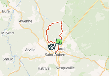
Route St Hubert
© OpenStreetMap contributors


3h48
Difficulty : Medium


Length
16 km
Max alt
582 m
Uphill gradient
396 m
Km-Effort
21 km
Min alt
412 m
Downhill gradient
441 m
Boucle
No
Creation date :
2022-08-13 09:11:37.0
Updated on :
2022-08-13 13:01:05.133
3h48
Difficulty : Medium
FREE GPS app for hiking
 SityTrail
IGN / Geographical institutes
SityTrail Plus
The world is yours!
About
Trail Walking of 16 km to be discovered at Wallonia, Luxembourg, Saint-Hubert. This trail is proposed by 000588.59a5cf7a30754ff494791288104e8256.1635.
Positioning
Country:
Belgium
Region :
Wallonia
Department/Province :
Luxembourg
Municipality :
Saint-Hubert
Location:
Unknown
Start:(Dec)
Start:(UTM)
669942 ; 5545146 (31U) N.
Comments