Trail Horseback riding Val-Revermont - 3 - Circuit des coteaux du Revermont - 4 jours                                             - Photo

3 - Circuit des coteaux du Revermont - 4 jours

 BOUDON
BOUDON

User

© OpenStreetMap contributors
Length
Length
114 km
Max alt
Max alt
570 m
Uphill gradient
Uphill gradient
2562 m
Km-Effort
Km-Effort  
148 km
Min alt
Min alt
192 m
Downhill gradient
Downhill gradient
2579 m
Boucle
Boucle
No
Creation date :
2022-08-14 16:35:40.055
Updated on :
2022-08-14 16:36:48.342

(0 Reviews)

Horseback riding
Horseback riding
19h26
Difficulty : Very difficult

Scan this QR Code to open this trail in the SityTrail application

FREE GPS app for hiking

Logo SityTrail SityTrail

IGN / Geographical institutes

Download SityTrail from the App Store Download SityTrail from Google Play

Logo SityTrail SityTrail World

The world is yours!

Download SityTrail from the App Store Download SityTrail from Google Play Download SityTrail on Huawei AppGallery

About

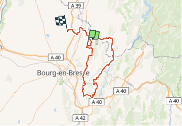
Trail Horseback riding of 114 km to be discovered at Auvergne-Rhône-Alpes, Ain, Val-Revermont. This trail is proposed by BOUDON.

Description

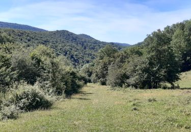
La petite montagne du Revermont et ses sentiers de randonnée bordés de petits murets de pierres vous feront découvrir des villages typiques qui ont conservé de nombreuses maisons vigneronnes taillées dans la pierre de la région.


Circuit de 4 jours :

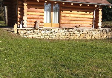
1) Cuisiat - Villeneuve les Charnod 18 km Du camping de la Grange du Pin au gîte de Serge et Françoise Brun
2) Villeneuve les Charnod - Villereversure 27 km Du gîte de Serge et Françoise Brun au relais de l'Agnoblens
3) Villereversure - Journans 22 km Du relais de l'Agnoblens au gîte du Puits
4) Journans - Cuisiat 26 km Du gîte du Puits au Camping de la Grange

Une variante de 5 jours est possible en faisant étape au Domaine d'Uzy à Marboz.
25 km depuis Cuisait et 29 km vers Villeneuvele Charnod
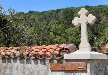
              A découvrir :

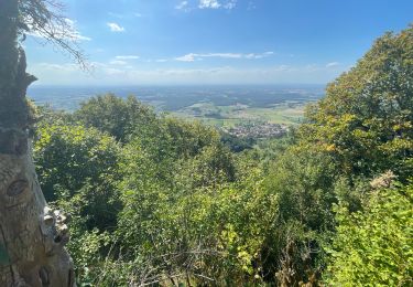
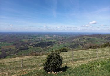
     L'église de ST Maurice d'Echazeaux et le point de vue
     La vallée du Suran
     Le lavoir de Tossiat Journans et la source de la Reyssouze
     Le village d'art de Meillonnas
     Le village médiéval de Treffort et son Chateau
     Le musée du Revermont à Cuisiat
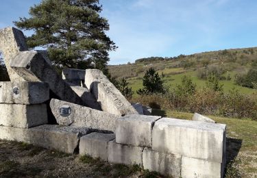
     Le sentier des pierres à Roissiat
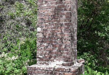
Eco-musée du moulin du pont des Vents à Montfleur

Mise à jour le 09/03/2022

Elevation profile

Points of interest

Point of interest Journans - Gîte du Puits - Photo
BOUDON
JOURNANS 
Point of interest Corveissiat - Belvédère  - Photo
BOUDON
CORVEISSIAT 
Point of interest Villereversure - L'Agnoblens - Photo
BOUDON
VILLEREVERSURE 
Point of interest Val-Revermont - camping de la Grange du Pin - Photo
BOUDON
Point of interest Val-Revermont - Musée du Revermont - Photo
BOUDON
VAL-REVERMONT 
Point of interest Val-Revermont - Chateau de Tréffort - Photo
BOUDON
VAL-REVERMONT 
Point of interest Courmangoux - Sentier des Pierres - Photo
BOUDON
COURMANGOUX 
Point of interest Marboz - Domaine d'Usy - Photo
BOUDON

Positioning

Country:
France
Region :
Auvergne-Rhône-Alpes
Department/Province :
Ain
Municipality :
Val-Revermont
Location:
Cuisiat
Start:(Dec)
Start:(UTM)
681345 ; 5130700 (31T) N.

Trails nearby

Trail Walking Val-Revermont - Mont Myon-Revermint - Photo
Walking
janussity

Walking

Medium
Val-Revermont, Auvergne-Rhône-Alpes, Ain, France
7 km | 11.3 km-effort
2h 8min
Yes
Trail Equestrian Val-Revermont - paque2019 - Photo
Equestrian
reve

Equestrian

Very easy
(1)
Val-Revermont, Auvergne-Rhône-Alpes, Ain, France
20 km | 24 km-effort
Unknown
No
Trail sport Val-Revermont - Reverront - Photo
sport
hl44lv

sport

Very easy
Val-Revermont, Auvergne-Rhône-Alpes, Ain, France
12.9 km | 18.3 km-effort
Unknown
Yes
Trail Walking Val-Revermont - Cuisiat, Pouillat, Nivigne, Rosy, col des justices - Photo
Walking
Praff

Walking

Difficult
Val-Revermont, Auvergne-Rhône-Alpes, Ain, France
21 km | 34 km-effort
6h 39min
Yes
Trail On foot Val-Revermont - Nivigne Cuisiat - Photo
On foot
Praff

On foot

Medium
Val-Revermont, Auvergne-Rhône-Alpes, Ain, France
15.2 km | 26 km-effort
5h 48min
Yes
Trail Walking Courmangoux - Chevignat Mont Verjon  - Photo
Walking
Jackoyo

Walking

Easy
Courmangoux, Auvergne-Rhône-Alpes, Ain, France
13.4 km | 19.7 km-effort
3h 9min
Yes
Trail Walking Val-Revermont - départ de cuisuiat ensuite la chapelle de montfort - Photo
Walking
colomb24

Walking

Medium
Val-Revermont, Auvergne-Rhône-Alpes, Ain, France
15.4 km | 24 km-effort
5h 27min
Yes
Trail Walking Val-Revermont - Signal de Nivigne par la grotte à l'Ours  - Photo
Walking
MarcVachet

Walking

Medium
Val-Revermont, Auvergne-Rhône-Alpes, Ain, France
7 km | 12 km-effort
2h 46min
Yes
Trail Walking Courmangoux - la crête du Grand Chevalet  - Photo
Walking
MarcVachet

Walking

Very easy
Courmangoux, Auvergne-Rhône-Alpes, Ain, France
4.3 km | 6.1 km-effort
1h 12min
Yes


Close
My subscriptions