Trail Walking Plan-de-Baix - Canyon des Gueulards - Plateau du Vellan  - Photo

Canyon des Gueulards - Plateau du Vellan

© OpenStreetMap contributors
Length
Length
18.7 km
Max alt
Max alt
1018 m
Uphill gradient
Uphill gradient
717 m
Km-Effort
Km-Effort  
28 km
Min alt
Min alt
536 m
Downhill gradient
Downhill gradient
714 m
Boucle
Boucle
Yes
Creation date :
2022-08-15 06:43:13.585
Updated on :
2022-08-17 08:06:58.578

(0 Reviews)

Walking
Walking
4h55
Difficulty : Medium

Scan this QR Code to open this trail in the SityTrail application

FREE GPS app for hiking

Logo SityTrail SityTrail

IGN / Geographical institutes

Download SityTrail from the App Store Download SityTrail from Google Play

Logo SityTrail SityTrail World

The world is yours!

Download SityTrail from the App Store Download SityTrail from Google Play Download SityTrail on Huawei AppGallery

About

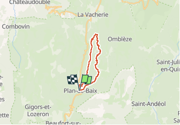
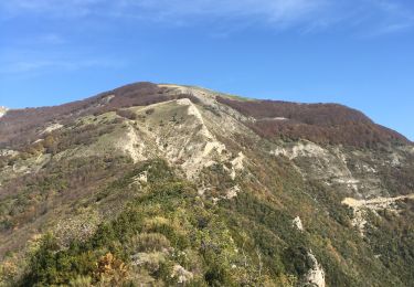
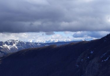
Trail Walking of 18.7 km to be discovered at Auvergne-Rhône-Alpes, Drôme, Plan-de-Baix. This trail is proposed by Philindy26.

Description

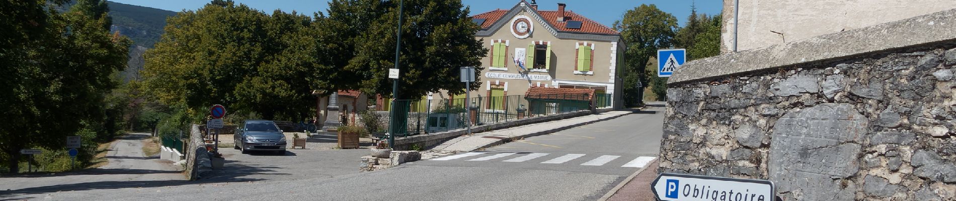
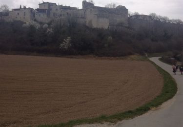
Départ du village de Plan-de-Baix...
Géolocalisation (Google Maps) : https://goo.gl/maps/jQueNbyGpCkkKiNJ6

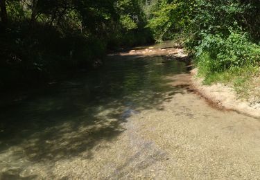
En partant du village de Plan de Baix (726 m), prendre la direction du Vialaret (759 m) et suivre les marques de couleur Jaune et vert pour arriver au ruisseau de la Gervanne. Continuer à suivre ces traces pour retrouver la route des Gorges d'Omblèze (560 m) que vous suivrez jusqu'à Baume Noir (580 m).
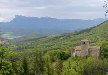
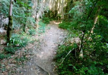
Après un aller-retour à la Pissoire (Facultatif), prendre le sentier et suivre les panneaux pour atteindre le Canyon des Gueulards (680 m) en passant par le Grand Cros (665 m), Corbière (645 m) et la Ferme du Peschers (670 m). Remonter tout le Canyon pour arriver aux ruines de Chaffal et retrouver le GR9.
Puis traverser le Plateau du Vellan en suivant la piste (GR9) jusqu'à la Croix du Rocher du Vellan (923 m). Tout en suivant le GR9 descendre sur le village de Plan-de-Baix pour retrouver le parking...

Elevation profile

Photos

154 photos in total. Please click on a photo to see them all in the gallery.

Positioning

Country:
France
Region :
Auvergne-Rhône-Alpes
Department/Province :
Drôme
Municipality :
Plan-de-Baix
Location:
Unknown
Start:(UTM)
671169 ; 4964450 (31T) N.

Trails nearby

Trail Walking Gigors-et-Lozeron - Gigors - Saint-Supière - Photo
Walking
Philindy26

Walking

Medium
(1)
Gigors-et-Lozeron, Auvergne-Rhône-Alpes, Drôme, France
11 km | 18.1 km-effort
4h 0min
Yes
Trail Walking Gigors-et-Lozeron - St Supière et Savel à Gigors et Lozeron - Photo
Walking
tracegps

Walking

Difficult
(1)
Gigors-et-Lozeron, Auvergne-Rhône-Alpes, Drôme, France
11.2 km | 17.9 km-effort
4h 0min
Yes
Trail Walking Beaufort-sur-Gervanne - Beaufort St Pancrace 17km - Photo
Walking
GUIDE
thonyc

Walking

Medium
(1)
Beaufort-sur-Gervanne, Auvergne-Rhône-Alpes, Drôme, France
15 km | 21 km-effort
5h 0min
Yes
Trail Walking Omblèze - Bec pointu Tête Dame - Photo
Walking
fabal

Walking

Difficult
(1)
Omblèze, Auvergne-Rhône-Alpes, Drôme, France
12.7 km | 26 km-effort
5h 12min
Yes
Trail Walking Omblèze - Bec Pointu - Photo
Walking
ajd26

Walking

Medium
Omblèze, Auvergne-Rhône-Alpes, Drôme, France
14.5 km | 27 km-effort
5h 10min
Yes
Trail Walking Beaufort-sur-Gervanne - 26 gervanne druise plan de baix - Photo
Walking
himba26100

Walking

Medium
Beaufort-sur-Gervanne, Auvergne-Rhône-Alpes, Drôme, France
16.8 km | 23 km-effort
7h 57min
Yes
Trail Walking Plan-de-Baix - Le Canyon des Gueulards - Photo
Walking
AIGUIER

Walking

Difficult
Plan-de-Baix, Auvergne-Rhône-Alpes, Drôme, France
14.2 km | 22 km-effort
4h 27min
Yes
Trail Walking Beaufort-sur-Gervanne - Beaufort sur gervanne - Photo
Walking
AIGUIER

Walking

Medium
Beaufort-sur-Gervanne, Auvergne-Rhône-Alpes, Drôme, France
13.4 km | 20 km-effort
4h 40min
Yes
Trail Walking Omblèze - Bec pointu par les blaches - Photo
Walking
bymarc26

Walking

Difficult
Omblèze, Auvergne-Rhône-Alpes, Drôme, France
9.8 km | 19.7 km-effort
3h 16min
Yes


Close
My subscriptions