


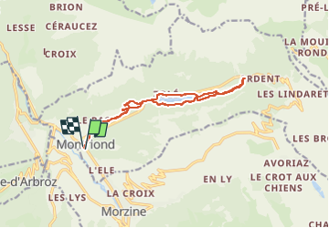
de Montriond à la cascade d’Ardent

micheldutilleul
User

Length
13.6 km

Max alt
1193 m

Uphill gradient
432 m
Km-Effort
19.4 km

Min alt
936 m

Downhill gradient
436 m
Boucle
Yes
Creation date :
2022-08-15 10:15:39.841
Updated on :
2022-08-15 16:12:35.043
2h56
Difficulty : Medium

FREE GPS app for hiking
 SityTrail
IGN / Geographical institutes
SityTrail Plus
The world is yours!
About
Trail Walking of 13.6 km to be discovered at Auvergne-Rhône-Alpes, Upper Savoy, Montriond. This trail is proposed by micheldutilleul.
Photos


Positioning
Country:
France
Region :
Auvergne-Rhône-Alpes
Department/Province :
Upper Savoy
Municipality :
Montriond
Location:
Unknown
Start:(Dec)
Start:(UTM)
322151 ; 5118414 (32T) N.
Comments