


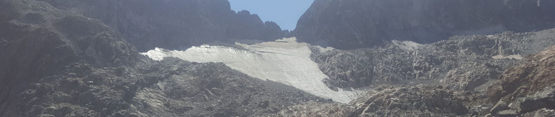
Breche d'Argentiere

ranchoup
User
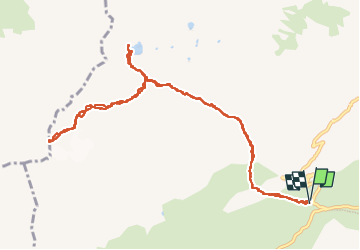

Length
13.2 km

Max alt
2705 m

Uphill gradient
985 m
Km-Effort
26 km

Min alt
1911 m

Downhill gradient
981 m
Boucle
Yes
Creation date :
2022-08-16 06:32:31.349
Updated on :
2022-08-17 06:23:31.668
9h30
Difficulty : Difficult

FREE GPS app for hiking
 SityTrail
IGN / Geographical institutes
SityTrail Plus
The world is yours!
About
Trail Walking of 13.2 km to be discovered at Auvergne-Rhône-Alpes, Savoy, Saint-Colomban-des-Villards. This trail is proposed by ranchoup.
Photos


Positioning
Country:
France
Region :
Auvergne-Rhône-Alpes
Department/Province :
Savoy
Municipality :
Saint-Colomban-des-Villards
Location:
Unknown
Start:(Dec)
Start:(UTM)
278275 ; 5013465 (32T) N.
Comments