


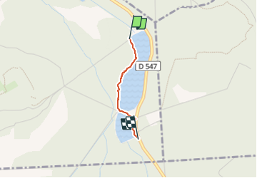
étang saint pierre

NESTOR2714
User

Length
1.1 km

Max alt
69 m

Uphill gradient
9 m
Km-Effort
1.3 km

Min alt
60 m

Downhill gradient
6 m
Boucle
No
Creation date :
2022-08-07 14:54:35.572
Updated on :
2022-08-18 09:34:38.294
18m
Difficulty : Easy

FREE GPS app for hiking
 SityTrail
IGN / Geographical institutes
SityTrail Plus
The world is yours!
About
Trail Walking of 1.1 km to be discovered at Hauts-de-France, Oise, Vieux-Moulin. This trail is proposed by NESTOR2714.
Positioning
Country:
France
Region :
Hauts-de-France
Department/Province :
Oise
Municipality :
Vieux-Moulin
Location:
Unknown
Start:(Dec)
Start:(UTM)
497559 ; 5469685 (31U) N.
Comments