


Bagat - saint pantaleon

Glurps
User
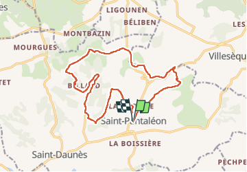

Length
18.2 km

Max alt
296 m

Uphill gradient
313 m
Km-Effort
22 km

Min alt
189 m

Downhill gradient
315 m
Boucle
Yes
Creation date :
2022-08-16 08:21:20.0
Updated on :
2022-08-19 22:25:28.893
4h54
Difficulty : Medium

FREE GPS app for hiking
 SityTrail
IGN / Geographical institutes
SityTrail Plus
The world is yours!
About
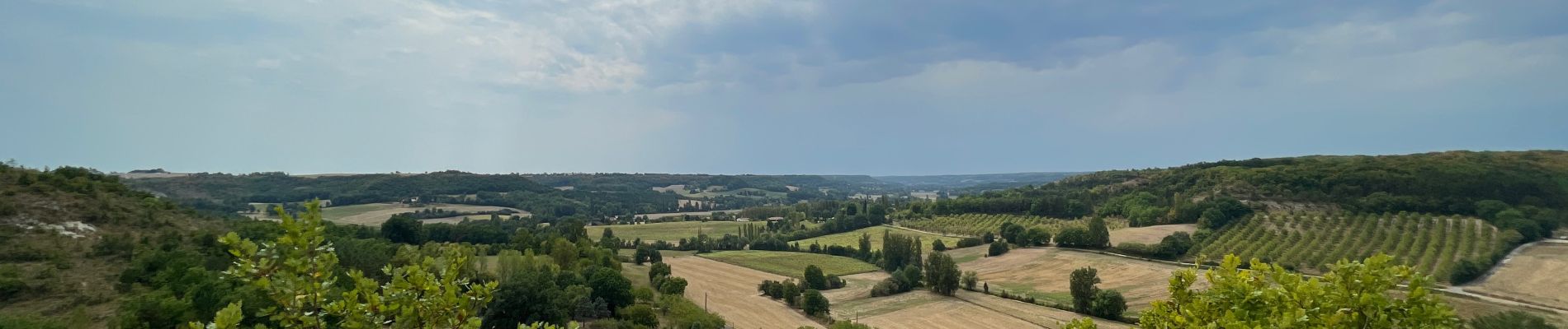
Trail Walking of 18.2 km to be discovered at Occitania, Lot, Barguelonne-en-Quercy. This trail is proposed by Glurps.
Photos


Positioning
Country:
France
Region :
Occitania
Department/Province :
Lot
Municipality :
Barguelonne-en-Quercy
Location:
Unknown
Start:(Dec)
Start:(UTM)
361878 ; 4914185 (31T) N.
Comments