


Tour du Plateau d’Ambel

alinetpierre
User
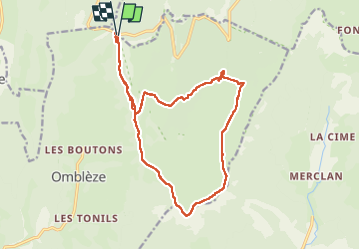

Length
18.5 km

Max alt
1502 m

Uphill gradient
629 m
Km-Effort
27 km

Min alt
1197 m

Downhill gradient
634 m
Boucle
Yes
Creation date :
2022-08-21 07:48:41.0
Updated on :
2022-08-21 12:47:20.766
4h11
Difficulty : Medium

FREE GPS app for hiking
 SityTrail
IGN / Geographical institutes
SityTrail Plus
The world is yours!
About
Trail Walking of 18.5 km to be discovered at Auvergne-Rhône-Alpes, Drôme, Bouvante. This trail is proposed by alinetpierre.
Description
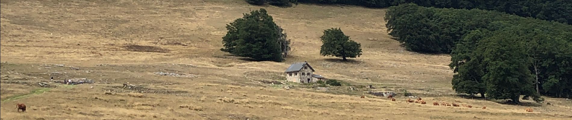
Tout simplement superbe
Photos


Positioning
Country:
France
Region :
Auvergne-Rhône-Alpes
Department/Province :
Drôme
Municipality :
Bouvante
Location:
Unknown
Start:(Dec)
Start:(UTM)
676383 ; 4974013 (31T) N.
Comments