


la cime de la bercha

pln30
User
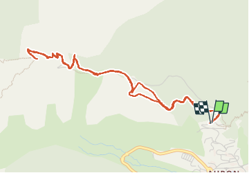

Length
6.4 km

Max alt
2190 m

Uphill gradient
498 m
Km-Effort
13 km

Min alt
1681 m

Downhill gradient
498 m
Boucle
Yes
Creation date :
2022-08-28 07:25:55.948
Updated on :
2022-09-03 07:02:10.817
3h35
Difficulty : Difficult

FREE GPS app for hiking
 SityTrail
IGN / Geographical institutes
SityTrail Plus
The world is yours!
About
Trail Walking of 6.4 km to be discovered at Provence-Alpes-Côte d'Azur, Maritime Alps, Saint-Étienne-de-Tinée. This trail is proposed by pln30.
Description
petite randonnée au depart d'auron jusqu'à la cime de la bercha
vous pouvez retrouver en video cette randonnée sur ma chaine youtube : air view channel
Positioning
Country:
France
Region :
Provence-Alpes-Côte d'Azur
Department/Province :
Maritime Alps
Municipality :
Saint-Étienne-de-Tinée
Location:
Unknown
Start:(Dec)
Start:(UTM)
334646 ; 4899594 (32T) N.
Comments