


Margériaz-G1-variante1

papou73
User
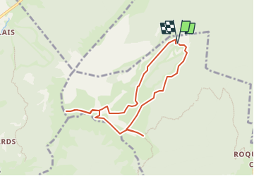

Length
7.8 km

Max alt
1809 m

Uphill gradient
465 m
Km-Effort
14 km

Min alt
1382 m

Downhill gradient
464 m
Boucle
Yes
Creation date :
2022-08-29 14:31:03.488
Updated on :
2022-08-29 14:33:15.408
3h11
Difficulty : Difficult

FREE GPS app for hiking
 SityTrail
IGN / Geographical institutes
SityTrail Plus
The world is yours!
About
Trail Walking of 7.8 km to be discovered at Auvergne-Rhône-Alpes, Savoy, Aillon-le-Jeune. This trail is proposed by papou73.
Description
Tracé à reconnaître
Positioning
Country:
France
Region :
Auvergne-Rhône-Alpes
Department/Province :
Savoy
Municipality :
Aillon-le-Jeune
Location:
Unknown
Start:(Dec)
Start:(UTM)
271016 ; 5058523 (32T) N.
Comments