


Trek Buet 2 - Mont Buet

arno55v
User

Length
21 km

Max alt
2774 m

Uphill gradient
1243 m
Km-Effort
40 km

Min alt
1068 m

Downhill gradient
1821 m
Boucle
No
Creation date :
2014-12-10 00:00:00.0
Updated on :
2014-12-10 00:00:00.0
7h47
Difficulty : Medium

FREE GPS app for hiking
 SityTrail
IGN / Geographical institutes
SityTrail Plus
The world is yours!
About
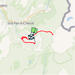
Trail Walking of 21 km to be discovered at Auvergne-Rhône-Alpes, Upper Savoy, Sixt-Fer-à-Cheval. This trail is proposed by arno55v.
Description
15 cm de neige le 16 aout 2014.
Positioning
Country:
France
Region :
Auvergne-Rhône-Alpes
Department/Province :
Upper Savoy
Municipality :
Sixt-Fer-à-Cheval
Location:
Unknown
Start:(Dec)
Start:(UTM)
329618 ; 5099974 (32T) N.
Comments